A Whiteparish local history page from younsmere-frustfield.org.uk
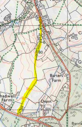
Love Lane on a modern map (north up)
Love Lane ran across Whelpley Manor from Common Road opposite All Saints School to Holmere Common, skirting land that had been given to Downton Free School and dividing it from the western part (Rowell's) of Golding's and Rowell's Farm (also see Golden Farm - combine these two pages). It seems probable that this lane was in originally in use before Rowells was assarted from the common land. See Whiteparish Common, Holmere Common and Hayter's Wood (part of Blaxwell Manor).
The map below (east at top of map) shows land ownership in 1842, with the land belonging to the Downton Free Schools in dark red. See Tithe Map Landowners and Tithe Map Occupiers for more detail.
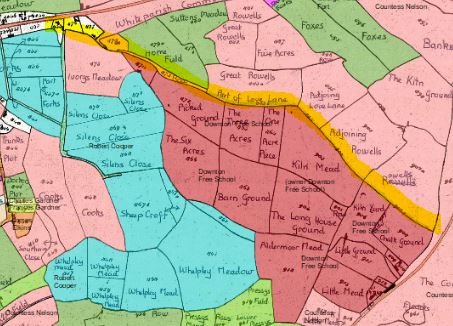
Love Lane (yellow line) on the 1842 Tithe Map (north to left of map)
Love Lane shouldn't be confused with the footpath that starts opposite the church, crosses Parsonage Meadow and Clay Street and then divides to reach the A36 at two points, one at Chadwell Farm and one further west.